 |
Litchfield Park Road in Litchfield National
Park, Northern Territory, Australia
|
|
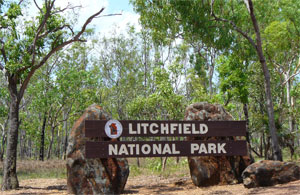 |
Litchfield
Park Road Litchfield
Park Road start from Batchelor townships and winds
gradually and scenically through Litchfield national
park to intersect with the South 4X4 Access Road that
follows onto intersect with Daly river Road and leads
back to Dorat Road that brings you back onto the Stuart
Highway at Adelaide River Township. (See the map by
tourism NT below)
THE Litchfield Park Rd will finally be completely
sealed — more than a decade after different NT governments
first promised it, Territory Labor has pledged 18.12.2016
http://www.ntnews.com.au/
|
|
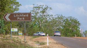 |
Litchfield
Park Road Litchfield
Park Road is the road we took to get into Litchfield
National Park. You can
see here on Litchfield Park Road we turned left to start
our rote into the park and staright ahead went to a
dead end for the mine site.
|
|
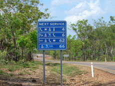 |
Litchfield
Park Road Litchfield
Park Road - The next service signs are the one we always
appreciate. these signs simply show the the next service
available on that particular road such as accommodation,
fuel, information, meals and even toilets sometimes
etc.
|
|
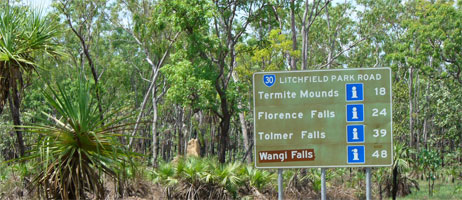 |
Litchfield
Park Road Litchfield
Park Road - Signs Florence
Falls, Tomler Falls, Wangi Falls, Buley Rockhole, The
Magnetic Termite Mounds. Excellent signs that let you
calculate your fuel when selfdriving.
|
|
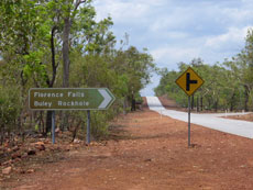 |
Litchfield
Park Road Litchfield
Park Road has a lot of signs that blend into the surrounds.
Wildlife and Parks have really done a good job of blending
signs into the enviroment here. Signs Florence
Falls, Tomler Falls, Wangi Falls, Buley Rockhole, The
Magnetic Termite Mounds as so numerous even Marg
my wife could find her way around.
|
|
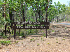 |
Litchfield
Park Road Litchfield
Park Road - Signage often refers to campers. Such as
this sign advising folks they can collect fireaood only
from near the roadside not in the bush. Actually
don't wander off into the bush or let the children because
a few 360% turns later and you will find your self rather
lost as the bush looks all the same.
|
|
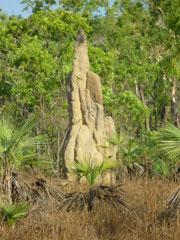 |
Litchfield
Park Road Litchfield
Park Road along the way you may see the Magnetic
Termite Mounds and Cathedral Termite Mounds from
the edge of the sealed roadside.
|
|
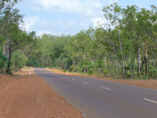 |
Litchfield
Park Road Litchfield
Park Road - is one of the most scenice drives in the
Top End we have encountered. We clocked up around 145klm
from Batchelor back to Batchelor after seeing Florence
Falls, Tomler Falls, Wangi Falls, Buley Rockhole, The
Magnetic Termite Mounds, Litchfield National Park Cafe
and Latitude 13.08 Safari Campsite.
|
|
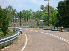 |
Finnis River
This section can be impassable at the Finnis
River crossing, from December to March.Access: Batchelor
is accessible via the Stuart Highway from Darwin, or
the Litchfield Park Road (gravel) off the Cox Peninsula
Road. Generally speaking most residents of Batchelor
travel to Darwin via the Stuart Highway, involving a
trip of approximately one hour. Access to Litchfield
National Park from the Cox Peninsula Road has 42kms
of formed gravel and is generally of good quality, however
after heavy rains numerous washouts appear which can
make the road treacherous. This route to Darwin involves
a journey of just over two hours but can be impassable
at the Finniss River crossing, from December to March.
|
|
|
|
|
|
|
|
|
|
|
|
|
Australia 4 Wheel Drive
Rentals
|
|
|
|
|
|
|
|
|
|
 |
|
|
|
|
|
|


